Most viewed - Virginia Counties
|

june2006pic 021.jpg818 viewsPhoto June 10, 2006 by Jeff Weaver
|
|

EastMainStreetSaltvilleinthe40s(3).jpg818 viewsThis view of East Main Street was made in the 1940s. Courtesy of Don Smith dsmith1043@comcast.net
|
|

wagonfactry.jpg818 viewsThis is a 1907 photo. Courtesy of Mary C. Blevins.
|
|

wythevillebusdepot.jpg817 viewsFrom a 1950s real photo postcard
|
|

friesrr1910.jpg817 viewsThis is from a 1910s postcard.
|
|

Tuggle Gap - Blue Ridge Parkway817 viewsFrom a 1950s photo from the Library of Congress Collection.
|
|
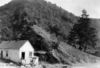
Allison Gap - Price Mountain817 viewsRidge making ledge of Price Mountain, probably to of Chemung strata, Allison Gap. No date, but circa 1910, Image from the U.S.Geological Survey.
|
|

Mouth of Wilson - Potato Creek Methodist Church Cemetery817 viewsImage of Martha Halsey's gravemarker, Courtesy of Misty Martin.
|
|

Picture 075.jpg816 viewsPhoto May 3, 2006 by Jeff Weaver.
|
|

whitetophotel.jpg816 viewsThis is a circa 1933 view of the Whitetop Hotel.
|
|

Chilhowie - Bradley's Funeral Home816 viewsLocated on Old Stage Road between the Tate House and the Chilhowie Methodist Church. Their website has their obituaries for their Marion and Chilhowie locations. Photo by Jeff Weaver, June 19, 2007.
|
|

Allison Gap - Geological Formations816 viewsRidge making ledge of Price Mountain, probably to of Chemung strata, Allison Gap. Abingdon quadrangle. Virginia. No date,but circa 1910.
Image from the U.S. Geological Survey
|
|
| 2351 files on 196 page(s) |
 |
|
|
|
|
|
|
|
|
91 | |
|
|
|
|
|
|
|
|