Skip to content

New River Notes Photo Gallery

A Collection of historic and current photos mostly covering the upper New River area of southwestern Virginia and northwestern North Carolina.


Bland County, VA


bluegrasstrail.jpg

12 files, last one added on Feb 20, 2007
Album viewed 1120 times

Carroll County, VA


Llama(2).jpg

52 files, last one added on Feb 19, 2008
Album viewed 2567 times

Dickenson County, VA


dcty12.jpg

9 files, last one added on Sep 19, 2013
Album viewed 622 times

Grayson County, VA, Western Communities


Flora_Baker_Reed_and_Children_Courtesy_of_Louise_Vanover_Vore.jpg

4 files, last one added on Feb 16, 2013
Album viewed 1654 times

Floyd County, VA


hotelbrame.jpg

12 files, last one added on Jul 28, 2007
Album viewed 1020 times

Giles County, VA


nrgiles38.jpg

26 files, last one added on Oct 09, 2007
Album viewed 921 times

Grayson County and City of Galax, VA


graypl~0.gif

Photos of physical features from Grayson County, and the City of Galax, Virginia.

631 files, last one added on Mar 28, 2015
Album viewed 4448 times

Montgomery County, VA


InglesCastle.jpg

109 files, last one added on Mar 08, 2008
Album viewed 1616 times

Pulaski County, VA


pulaskiaerial.jpg

48 files, last one added on Mar 08, 2008
Album viewed 8376 times

Smyth County, VA


100_1542.jpg

948 files, last one added on Nov 17, 2010
Album viewed 48502 times

Tazewell County, VA


clinchriver.jpg

56 files, last one added on Nov 17, 2010
Album viewed 1803 times

Washington County, VA


Old Train Station May2004.JPG

269 files, last one added on Nov 17, 2010
Album viewed 2864 times

14 albums on 2 page(s) 1

Random files - Virginia Counties
GHS class of 1931.jpg
GHS class of 1931.jpg3071 viewsCourtesy of Judy Alley
fieldofbeans.jpg
Saltville - Field pf Beans651 viewsField of beans planted along contours so as to prevent washing on steep slopes. Walker Mountain (M 15). Abingdon quadrangle. Virginia. No datembut circa 1910. From the U. S. Geological Survey.

independencehs.jpg
Independence - Grayson County High School327 viewsThis is a 1960s aerial view of the Grayson County High School.
wythevillereedcreekbridge.jpg
wythevillereedcreekbridge.jpg622 viewsThis postcard showing the bridge over Reed Creek in Wytheville was mailed in 1915.
railfence.jpg
railfence.jpg309 viewsFrom the Office of War Information Collection at the Library of Congress.
pics 427.jpg
Fees Ridge - Gold Mine Tailings Pile354 viewsPhoto September 2007 by Jeff Weaver. This is the remnant of a gold mine that was exhausted in the late 19th century.
100_1659.jpg
100_1659.jpg334 viewsPhoto April 23, 2006 by Jeff Weaver.
bluegrasstrail.jpg
Bland - Blue Grass Trail645 viewsThis 1953 postcard shows the Blue Grass Trail near Bland. The image was probably taken from atop Walker Mountain.

Last additions - Virginia Counties
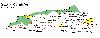
graypl~0.gif
Grayson County Places473 viewsMar 28, 2015
BridleCreekSchool.jpg
Bridle Creek School461 viewsDec 16, 2014
dcty12.jpg
Bear Pen School.362 viewsSep 19, 2013
dcty8.jpg
This is another historical marker for the town of Clintwood.337 viewsSep 19, 2013
dcty7.jpg
Dickenson County, Virginia's Coal Miners Memorial322 viewsSep 19, 2013
dcty6.jpg
This is a Bold Creek Church meeting.345 viewsSep 19, 2013
dcty4.jpg
419 viewsSep 19, 2013
dcty3.jpg
Dickenson County, Virginia's Veterans Memorial308 viewsSep 19, 2013