Most viewed - Virginia Counties
|

Foster Falls - Foster Falls Furnance.1061 viewsFoster Falls Furnace, Foster Falls, VA., Wythe Co.
--------------------------------------------------------------------------------
"For most of the 19th century, the mineral-rich New River Valley supported great industrial activity. Iron ore mines in the valley supplied the raw materials for dozens of iron furnaces and forges and the iron business became a major force in the regional economy. By the turn of the century how3ever, changes in technology and a depletion of the natural resources necessary for iron production had forced most of the furnaces out of business.
Foster Falls Furnace was built in 1880-81 by the Foster Falls Mining and Manufacturing Co. The furnace, described as an open top cold blast operation was run by water power from the New River and produced pig iron to the tune of 12 tons per day. Raw iron ore was transported to the furnace from mines in the Red Hill area of Wythe County aboard narrowguage railroads called "dinky" trains. The finished product was shipped to markets in St. Louis, Baltimore, and Cincinnati. At its peak, the furnace employed between 70 and 80 people.
In 1899 the furnace was sold to Virginia Iron Coal and Coke Co. and converted to a steam powered operation, increasing its production capacity. During Virginia Iron Coal and Coke ownership of the furnace, over 100 company owned homes were built in the vicinity to house its employees. The
Foster Falls Furnace operated until 1914, when a devastating flood destroyed the dinky train bridge over New River, cutting the supply of iron ore from the mines."--sign located on the site by the Virginia State Parks & Recreation Dept.
Photo by Shawn Dunford, courtesy of David Arnold david.arnold@adelphia.net
|
|
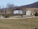
Crockett's Cove - Crockett Family Cemetery1059 viewsPhoto by Shawn Dunford, courtesy of David Arnold david.arnold@adelphia.net
|
|
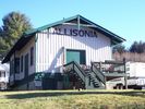
Allisonia - Allisonia Depot1059 viewsPhoto by Shawn Dunford, courtesy of David Arnold david.arnold@adelphia.net
|
|

palmeravesep71.jpg1057 viewsThis Don Smith (dsmith1043@comcast.net) photo shows a bustling Saltville downtown in September 1971.
|
|

Mouth of Wilson - Young's Chapel Baptist Church Cemetery1057 viewsPhoto March 17, 2008 by Jeff Weaver
|
|

Saltville - Snowy Day in December1056 viewsCourtesy of Don Smith dsmith1043@comcast.net
|
|

Grassy Creek - St. John's Lutheran Church1054 viewsPhoto by Jeff Weaver, May 2005.
|
|

Saltville - Big Tom and Sandy Buchanan Farm,1039 views Big Tom and Sandy Buchanan Farm, January 31, 2010. Courtesy of Don Smith
|
|
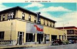
hotelpulaski.jpg1032 viewsThis view of the Hotel Pulaski was made in the 1930s.
|
|
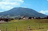
Pearisburg - Angel's Rest1032 viewsThis 1960s postcard shows the Angel's Rest mountain near Pearisburg.
|
|
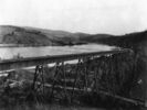
galaxtrestle.jpg1031 viewsThis is from a 1920s photo.
|
|
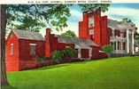
ftchiswell.jpg1026 viewsThis is a postcard of the Chiswell Mansion, near Wytheville, VA. You might be interested in Hauser's 1907 Short Historical and Physical Description of Wythe County, Virginia. This booklet was prepared for the 1907 Jamestown Exposition.
|
|
| 2351 files on 196 page(s) |
 |
 |
 |
 |
 |
7 |  |
 |
 |
 |
 |
 |
 |
 |
 |
 |
 |
 |
|


