Most viewed - Virginia Counties
|

000_0729.JPG864 viewsThis is an overlook of the scene of the principal battle of Saltville, October 2, 1864. Note the earthworks at the edge of the tree line about middle of the image. Photo by Jeff Weaver, June 2005.
|
|

cabbageatrr.jpg864 viewsThis 1930s photo shows cabbage being loaded onto railcars at Rural Retreat, VA. Cabbage were a stapple cash crop at this time.
|
|

grosecloserr.jpg864 viewsThe particulars about this photo have been lost except for the location. It appears to be from the late 19th century, and probably came from Tom Totten's collection. Courtesy of Don Smith dsmith1043@comcast.net
|
|
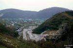
Saltville - Screening Plant864 viewsDISMANTLING THE SCREENING PLANT / OLIN / SALTVILLE, VA. / APRIL 1969. Courtesy of Don Smith dsmith1043@comcast.net
|
|
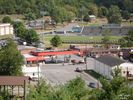
DSC02572.jpg863 viewsPhoto September 29, 2005 by Don Smith. dsmith1043@comcast.net
|
|
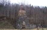
wattsbottomironfurnace.jpg863 viewsThis Iron Furnace is located just north of Ivanhoe near State Rt. 94 at "Watt's Bottom", Wythe County. Courtesy of David Arnold david.arnold@adelphia.net
|
|
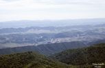
WHITEROCKSOLIN244.jpg862 viewsTHIS PICTURE WAS TAKEN IN JUNE OF 1972 FROM THE WEST END OF FLATTOP MOUNTAIN ON AN OUTCROPPING KNOWN AS THE WHITE ROCKS.
Courtesy of Don Smith dsmith1043@comcast.net
|
|
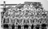
saltvillefootball1930s.jpg862 viewsThis is a photo of the 1937 Saltville Football team by John Porter.
|
|

Saltville March 1964862 viewsThis March 1964 photo shot looking east from Main Street, shows the company store in the center of the shot (red building), the train depot slightly to the left, and the bank further to the left. Courtesy of Don Smith dsmith1043@comcast.net
|
|

Saltville - Governmnet Plant Area862 viewsGOVERNMENT PLANT AND BROADY BOTTOM AREAS / APRIL 1969
THE PLOWED AREA AT RIGHT CENTER IS WHERE THE NORTHFORK MANOR PROJECT WOULD BE BUILT...THE AREA NEAR THE SILOS AND RESERVOIR IS WHERE THE ELIZABETH CEMETERY WAS ENLARGED TO IN 1986.
THE BUILDING AT UPPER LEFT UNDER CONSTRUCTION WOULD BECOME KENROSE MFG. AND LATER, ACCO. Courtesy of Don Smith[email]dsmith1043@comcast.net[/emai]
|
|

wytheweatherbldg.jpg861 viewsThis is a 1930-45 era postcard.
|
|
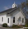
youngschapch.jpg860 viewsPhoto by Jeff Weaver 2004. This congregation was founded in 1845 and is co-located with the campus of the Oak Hill Academy.
|
|
| 2351 files on 196 page(s) |
 |
|
|
|
|
|
|
|
|
39 | |
|
|
|
|
|
|
|
|




