Most viewed - Virginia Counties
|

Picture 063~0.jpg540 viewsThis Church, located on a steep bank once housed a Methodist and Baptist congregation, principally African-American in ethnographic terms. Photo May 3, 2006 by Jeff Weaver
|
|
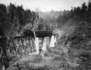
abingdonbranchsteam.jpg540 viewsThis photo was taken in the early 20th century on the Abingdon branch of the Norfolk and Western Railroad.
|
|
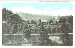
pocahontascem1920.jpg540 viewsThis is a circa 1920 postcard view.
|
|
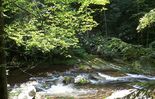
tumblingcreekfalls3.jpg539 viewsLocated near Saltville, this photo by Jeff Weaver in the summer of 2003, shows the falls from above.
|
|

Blacksburg - Virginia Tech 539 viewsThis view of the Virginia Tech Campus was taken in the 1950s.
|
|

100_1370.jpg539 viewsPhoto by Jeff Weaver, March 30, 2006.
|
|

100_1884.jpg539 viewsPhoto by Jeff Weaver, November 29, 2006.
|
|

Tumbling Cove - Big Tumbling Creek539 viewsPhoto March 30, 2007 by Jeff Weaver
|
|

Grassy Creek - Tobacco Harvest Time539 viewsPhoto by Jeff Weaver September 2007.
|
|
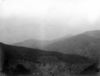
Tumbling Creek - Clinch Mountain539 viewsClinch Mountains from gap south of Beartown Mountain. Distant sharp peak is Whiterock; high ridge at right is Redrock with dip slope of Clinch sandstone on left forming syncline with distant ridge. Abingdon quadrangle. Virginia. No date. From the US Geological Service
|
|

troutdalecem.jpg538 viewsPhoto by Jeff Weaver, Winter 2003.
|
|

100_1417.jpg538 viewsPhoto April 2, 2006 by Jeff Weaver
|
|
| 2351 files on 196 page(s) |
 |
|
|
|
|
|
|
|
|
161 | |
|
|
|
|
|
|
|
|