Most viewed - Virginia Counties
|
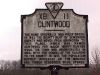
This is another historical marker for the town of Clintwood.588 views
|
|
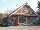
100_1656.jpg587 viewsThis old country store sits about 100 yards in Smyth County from the Wythe County line on Cedar Springs Road. Photo April 23, 2006 by Jeff Weaver.
|
|

100_1683.jpg587 viewsPhoto April 23, 2006 by Jeff Weaver.
|
|
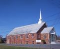
100_1284.jpg586 viewsPhoto by Jeff Weaver, March 18, 2006.
|
|

friesdam.jpg586 viewsPhoto of the dam across New River taken in the 1920s.
|
|
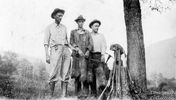
FARRISHOGSTONHENDERSON408.jpg586 viewsHUNTING TRIP TO BIG TUMBLING COVE...PICTURED FROM LEFT IS SID FARRIS, ROB HOGSTON, AND BOLEN HENDERSON. THE DATE IS OCTOBER 2, 1926.
Photo courtesy of Don Smith dsmith1043@comcast.net
|
|
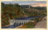
radfordpower.jpg586 viewsThis 1930-45 era postcard shows the hydroelectric power station for the City of Radford on Little River.
|
|

100_1822.jpg586 viewsPhoto November 1, 2006 by Jeff Weaver.
|
|

vcbasketball1966.jpg585 viewsThis photo shows the 1965-66 Virginia Carolina High School basketball team.
|
|
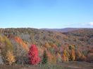
Haw Orchard - Sugarlands585 viewsThis photo was taken on October 18, 2006 by Jeff Weaver in Grayson Highlands State Park. It shows the color changes in the Sugar Maples this year.
|
|

Fees Ridge - Gold Mine Tailings Pile585 viewsPhoto September 2007 by Jeff Weaver. This is the remnant of a gold mine that was exhausted in the late 19th century.
|
|
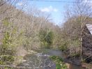
100_1631.jpg584 viewsThis is the view of the Middle Fork of the Holston River from Old Ebenezer Road, south of Marion. Photo April 23, 2006 by Jeff Weaver.
|
|
| 2351 files on 196 page(s) |
 |
|
|
|
|
|
|
|
|
146 | |
|
|
|
|
|
|
|
|