Most viewed - Virginia Counties
|

Pearisburg - Pearisburg Methodist Episcopal Church603 viewsThis is a 1910 color postcard.
|
|

damascus.jpg602 viewsThis is an early 20th century postcard.
|
|
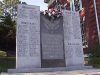
Dickenson County, Virginia's Veterans Memorial602 views
|
|

fallsoffox~0.jpg601 viewsSummer 2003, by Jeff Weaver
|
|

galaxsch.jpg601 viewsThis photograph was taken in the late 1930s.
|
|

100_1369.jpg601 viewsPhoto by Jeff Weaver, March 30, 2006.
|
|

Whitetop - Fall Scene601 viewsThis photo was taken October 18, 2006 by Jeff Weaver from the gounds of Faith Lutheran Church looking south.
|
|

100_1819.jpg601 viewsPhoto November 1, 2006 by Jeff Weaver. I know the little bird is hard to see, camoflague. The road is the National Forest Service road to Comer's Rock and Hale Lake.
|
|
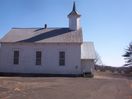
BrierpatchMountain - Jerusalem United Methodist Church601 viewsThis congregation was established in 1838. Photo by Jeff Weaver, February 2007.
|
|

Providence - Historical Marker601 viewsThis marker indicates the location of the first court held in Grayson County. Photo by Jeff Weaver, February 2007.
|
|

Mouth of Wilson - Phipps Dairy Farm601 viewsPhoto by Jeff Weaver, June 2007.
|
|

Red Rock Mountain601 viewsRed Rock from White Top - Highlighted by snow, the Red Rock Mountain section of the Clinch Range stands out in the distance as a far away marker for what lies below...the town of Saltville. The shot was taken from atop White Top Mountain roughly 25 miles south of Red Rock as the crow flies. At the time, Saltville's downtown temperature was 45 degrees and the temperature on White Top was 27 degrees.
Photo by Don Smith.
|
|
| 2351 files on 196 page(s) |
 |
|
|
|
|
|
|
|
|
141 | |
|
|
|
|
|
|
|
|