Most viewed - Virginia Counties
|

Fries - Blair's Ferry Homes656 viewsHomes at (historic) Blair's Ferry section of Town of Fries, Providence Dist., Grayson. These homes predate the Town of Fries. Photo by Shawn Dunford. Courtesy of David Arnold
|
|
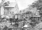
mowmill.jpg655 viewsThis 1910 photo shows the grist mill on Wilson Creek near its mouth.
|
|
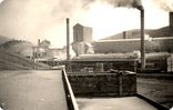
porterdryiceplant.jpg654 viewsThis is a 1937-40 image of the one of the industrial facilities operated by Mathieson Alkali Works in Saltville. Photo by John Porter, courtesy of Doug Ogle.
|
|
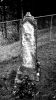
Mouth of Wilson - Potato Creek Methodist Church Cemetery653 viewsCourtesy of Misty Martin
|
|

Comers Rock Baptist Cem.jpg652 views
|
|

Groseclose - Settler's Musuem of Southwest Virginia652 viewsPhoto July 13, 2007 by Jeff Weaver.
|
|
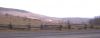
View of Mount Rogers from Route 600 at the Grayson - Smyth County Line, March 6, 2003651 views
|
|

peaktazewell.jpg650 viewsThis is a 1909 postcard.
|
|
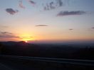
100_1265.jpg650 viewsThis is a photo of sunset over Clinch Mountain taken from Skull's Gap, between Konnarock and Chilhowie, VA. Taken 6:25 p.m., March 12, 2006 by Jeff Weaver.
|
|

Picture 118.jpg650 viewsFor a history of the Konnarock Training School, see Jean Shepherd Hamm's Ph.D. Dissertatio. Photo April 30, 2006 by Jeff Weaver.
|
|
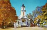
sherrychristianchurch.jpg650 viewsThis church was built in 1903. This photo from about 1965.
|
|
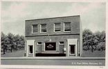
narrowspostoffice.jpg650 viewsThis is from a 1930 era postcard.
|
|
| 2351 files on 196 page(s) |
 |
|
|
|
|
|
|
|
|
129 | |
|
|
|
|
|
|
|
|