Skip to content

New River Notes Photo Gallery

A Collection of historic and current photos mostly covering the upper New River area of southwestern Virginia and northwestern North Carolina.


Most viewed - Virginia Counties
pics 142~0.jpg
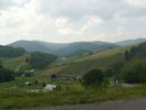
Rugby - Panoramic View564 viewsThe Church in the lower right is Corinth Baptist Church. The farm in the center of the photo was part of the old Tucker place, IIRC. Wayne Henderson's luthiers shop is across the road from these farm buildings, but obscured in this photo by trees. The road to the lower left leads to Helton, the roads to the right both lead to U.S. 58 and depending on the turn either to Whitetop or Volney. Taken from the dividing ridge between Grassy Creek and Rugby on June 26, 2007 by Jeff Weaver.
pinemtn1970.jpg
Troutdale - Pine Mountain564 viewsThis photo dates from the late 1960s.
piedmontschool.jpg
piedmontschool.jpg563 viewsThis photo circa. 1910 or so, is courtesy of Sadie Stamper Greer. Note the steam engine to the extreme right of the image.
FriesDam#5.jpg
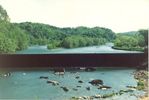
Fries Dam563 viewsPhoto courtesy of David Arnold
100_1893.jpg
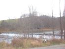
100_1893.jpg563 viewsAnother view of the Fields Dam across New River at Mouth of Wilson, VA. Photo November 29, 2006 by Jeff Weaver.
100_1946.jpg
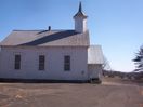
BrierpatchMountain - Jerusalem United Methodist Church563 viewsThis congregation was established in 1838. Photo by Jeff Weaver, February 2007.
100_2822.JPG
Oldtown - Church563 viewsTHIS UNIDNTIFIED CHURCH WAS PHOTOGRAPHD BY DAVID ARNOLD
pearisburgmechurch.jpg
Pearisburg - Pearisburg Methodist Episcopal Church562 viewsThis is a 1910 color postcard.
sulphurspgsmechurch.jpg
Edgewater - Sulphur Springs Methodist Church562 viewsPhoto courtesy of Stephen Isom sisom_484@yahoo.com
fallsoffox~0.jpg
fallsoffox~0.jpg561 viewsSummer 2003, by Jeff Weaver
indehs.jpg
indehs.jpg561 viewsThis photograph is from the late 1930s.
radfordpower.jpg
radfordpower.jpg561 viewsThis 1930-45 era postcard shows the hydroelectric power station for the City of Radford on Little River.
2351 files on 196 page(s) 126


[Edit]