Most viewed - Virginia Counties
|

vpiaerial.jpg682 viewsThis is a 1930-45 era aerial view of the Virginia Tech Campus.
|
|

mtrogerssign.jpg681 viewsMount Rogers was called Balsam Mountain by the locals before the powers that be imposed the name Mount Rogers on the place. Photo by Jeff Weaver, March 2003.
|
|

Roberts Cove - Barn681 viewsThis barn has seen better days. Photo by Jeff Weaver, March 21, 2008. Photoshopped into a watercolor image.
|
|

radfordcol.jpg680 viewsThis is a 1930-45 view of the Administration Building at Radford College, now Radford University.
|
|

107midwat.jpg680 viewsLOOKING NORTHWEST TOWARD SALTVILLE FROM THE MIDWAY AREA. THIS IS THE START OF HWY 107 IN THAT AREA. IT WOULD GO THROUGH THE GAP NEAR THE BARN IN THE PICTURE.
PLEASANT HEIGHTS WOULD BE DEVELOPED ON THE RIGHT SIDE OF THE PICTURE AND BEYOND.
PHOTO BY MYRL DUNHAM IN FEBRUARY 1964. Curtesy of Don Smith dsmith1043@comcast.net
|
|

100_1333.jpg679 viewsPhoto by Jeff Weaver, March 22, 2006.
|
|

royaloak.jpg679 viewsFrom a 1930s era postcard.
|
|

quarry.jpg679 viewsThis view of a limestone quarry, operated by Mathieson Alkali Works near Saltville was taken circa 1905.
|
|

Konnarock - Mr. Mailbox679 viewsPhoto by Jeff Weaver, July 28, 2007
|
|
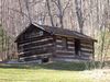
Comers Rock - Moss, Doley Cabin679 viewsphoo by Shawn Dunford. Courtesy of David Arnold davod-arnold@comcast.net
|
|
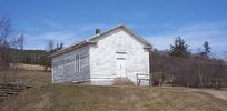
Barton's Cross Roads - Barton's Cross Roads Primitive Baaptist Church678 viewsThis building is on the Flat Ridge Road not far from Grant. Photo by Jeff Weaver, Spring 2003.
|
|
0948218-R1-024-10A~1.jpg678 viewsPhoto May 2006 by Sadie Greer
|
|
| 2351 files on 196 page(s) |
 |
|
|
|
|
|
|
|
|
123 | |
|
|
|
|
|
|
|
|