Most viewed - Washington County, VA
|
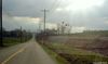
Emory - Eastbound Freight Norfolk Southern487 viewsEASTBOUND NORFOLK SOUTHERN / NEAR EMORY, VA. / EASTER SUNDAY MARCH 23, 2008 / 6:09 P.M. Courtesy of Don Smith dsmith1043@comcast.net
|
|
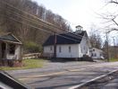
100_1438.jpg485 viewsThis church is housed in the building that was formerly the school for African American children in Saltville. It is located on Smokey Row. Photo April 2, 2006 by Jeff Weaver
|
|
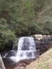
Damascus- Straight Branch485 viewsPhoto by Jeff Weaver, March 30, 2007
|
|
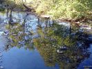
Hayters Gap - North Fork of Holston River485 viewsSYCAMORE REFLECTIONS / FROM RT. 80 BRIDGE NEAR HAYTER'S GAP, VA. / OCT. 14, 2007. Courtesy of Don Smith dsmith1043@comcast.net
|
|
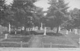
holstonconfcem.jpg483 viewsThis is a 1908 postcard.
|
|
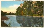
Abingdon - Holston River483 viewsThis postcard dating from the 1940s shows the Holston River near Abingdon. The river was absolutely critical in the settlement patterns of Washington County. You might be interested in The 1782 Washington County, Virginia Tax List
|
|
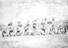
lester42.jpg482 viewsOnly three identified. First row next to the far right, Simon Thomas, far right, William Lester; Backrow far right Bower Thomas.
|
|

mwashinn.jpg481 viewsBuilt in the 1840s for Francis Preston, it became a Civil War Hospital, then a Methodist College for Women, and is now a very elegant hotel in downtown Abingdon. From a 1940s era postcard.
|
|

Clinchburg - Trestle481 viewsThis is the trestle at Tin Bridge Hollow. Photo by Jeff Weaver, January 12, 2007.
|
|

Konnarock - Mossy Log481 viewsThis moss covered log was found lying beside Whitetop Laurel Creek, near the Virginia Creeper Trail. Photo July 4, 2007 by Jeff Weaver.
|
|

100_1341.jpg480 viewsPhoto March 24, 2006, by Jeff Weaver
|
|

WHITESMILL413.jpg480 viewsA Frozen over White's Mill, photo taken February 1971 by Don Smith dsmith1043@comcast.net
|
|
| 269 files on 23 page(s) |
 |
|
|
|
6 | |
|
|
|
|
|
|
|
|
|
|
|
|
|




