Most viewed - Washington County, VA
|
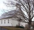
chilhowiepbc.jpg520 viewsThis church, formerly the home of Ebbing Springs Presbyterian Church, is located on Route 91, south of Glade Spring. Photo March 2003, by Jeff Weaver
|
|

abingdon10.jpg518 viewsFrom the People's National Bank of Abingdon, VA.
|
|

glade1860.jpg518 viewsThis wood cut purports to show the village of Glade Spring ca. 1840. The mountain in the background is Whitetop, perhaps exaggerated.
|
|
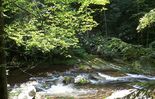
tumblingcreekfalls3.jpg517 viewsLocated near Saltville, this photo by Jeff Weaver in the summer of 2003, shows the falls from above.
|
|

whitesmillabingdon.jpg517 viewsThis is from a 1950s/1960s era postcard.
|
|

Konnarock - Whitetop Laurel Creek Falls517 viewsPhoto July 4, 2007 by Jeff Weaver. One must hike down a rather steep trail to reach a point for a good view of this falls.
|
|
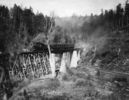
abingdonbranchsteam.jpg516 viewsThis photo was taken in the early 20th century on the Abingdon branch of the Norfolk and Western Railroad.
|
|
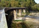
Alvarado - Railroad Trestle516 viewsA RAILROAD FROM ABINGDON, VA. LINKING SEVERAL SMALL TOWNS AND COMMUNITIES WAS STARTED IN THE 1880s. BY 1918 IT RAN FROM ABINGDON TO ELKLAND, N. C. WHICH IS NOW CALLED TODD. DAMASCUS, TAYLOR'S VALLEY, GREEN COVE AND WHITE TOP WERE AMONG THE STOPS ON IT'S ROUTE. THERE WERE 100 TRESTLES AND BRIDGES ON THE RAIL LINE.
THE VIRGINIA CREEPER WAS STEAM POWERED AND HAULED FREIGHT AND PASSENGERS. THE STEAM ENGINE WAS REPLACED BY N&W IN 1956 WITH A DIESEL LOCOMOTIVE. IT CONTINUED IN OPERATION UNTIL MARCH 31, 1977 WHEN THE LAST TRAIN RAN. THE ROADBED HAS BEEN CONVERTED TO A VERY POPULAR HIKING-BIKING TRAIL. PICTURED IS THE TRESTLE AT THE HEADWATERS OF SOUTH HOLSTON LAKE WHERE THE MIDDLE AND SOUTH FORKS OFTHE HOLSTON RIVER MEET. Courtesy of Don Smith dsmith1043@comcast.net
|
|
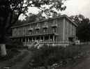
washhotelglade.jpg512 viewsFrom an early 20th century photo.
|
|
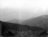
Tumbling Creek - Clinch Mountain512 viewsClinch Mountains from gap south of Beartown Mountain. Distant sharp peak is Whiterock; high ridge at right is Redrock with dip slope of Clinch sandstone on left forming syncline with distant ridge. Abingdon quadrangle. Virginia. No date. From the US Geological Service
|
|
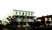
Meadowview - Health Clinic511 viewsPhoto by Jeff Weaver, Octooher 2007.
|
|

Tumbling Cove - Clinch Mountain Wildlife Management Area504 viewsPhoto by Jeff Weaver, March 30, 2007
|
|
| 269 files on 23 page(s) |
 |
3 | |
|
|
|
|
|
|
|
|
|
|
|
|
|
|
|
|




