Most viewed - Washington County, VA
|

Old Train Station May2004.JPG441 viewsMade famous by O. Winston Link, this is a May 2004 photo of the Green Cove Station. Courtesy of Roxanna rnrgen@aol.com
|
|
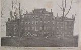
ehcollege1908.jpg441 viewsThis is a 1908 postcard view of the main Emory Building at the time.
|
|
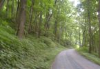
Tumbling Creek - Road to the Lake441 viewsThis road lies in the old railroad bed which led to the top of Clinch Mountain. There are numerous switchbacks. It leads to Laurel Bed Lake at the top of Clinch Mountain. Photo July 14, 2007 by Jeff Weaver.
|
|

rt11abingdon.jpg440 viewsThis is a 1930-45 view of Route 11 between Abingdon and Bristol.
|
|
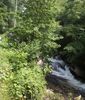
tumblingcreekfalls2.jpg439 viewsLocated near Saltville, VA in Washington county, VA. This photo by Jeff Weaver, summer 2003.
|
|

Tumbling Cove - Big Tumbling Creek439 viewsPhoto March 30, 2007 by Jeff Weaver
|
|

100_1362.jpg438 viewsPhoto by Jeff Weaver, March 29, 2006.
|
|

gladeexperimentstation.jpg438 viewsThis mid-20th century aerial view shows the Virginia Tech Agriculture Experiment Station at Glade Spring, Virginia.
|
|

kellyschapel1.jpg438 viewsPhoto April 2006 by Jerry W. Catron.
|
|

PICT0389.JPG438 viewsThis is located in the Holston Conference Cemetery, Emory, VA. Photo May 12, 2006 by Jeff Weaver.
|
|

abingdonpo1911.jpg438 viewsThis postcard view was mailed in 1911.
|
|
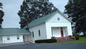
pics 066.jpg438 viewsOrganized about 1845, this photo September 15, 2006 by Jeff Weaver.
|
|
| 269 files on 23 page(s) |
 |
|
|
|
|
|
|
|
|
13 | |
|
|
|
|
|
|
|
|




