Skip to content

New River Notes Photo Gallery

A Collection of historic and current photos mostly covering the upper New River area of southwestern Virginia and northwestern North Carolina.


Most viewed - Washington County, VA
ALVARADsfholston.jpg
Alvarado - South Fork of Holston River432 viewsSOUTH FORK OF THE HOLSTON / ALVARADO, VA. / 3:40 P. M. / JUNE 12, 2007. Courtesy of Don Smith dsmith1043@comcast.net
barter1945.jpg
barter1945.jpg431 viewsThis is a circa 1945 view. The theater, the state theater of Virginia, was established in 1933.
Old Train Station May2004.JPG
Old Train Station May2004.JPG431 viewsMade famous by O. Winston Link, this is a May 2004 photo of the Green Cove Station. Courtesy of Roxanna rnrgen@aol.com
gladeexperimentstation.jpg
gladeexperimentstation.jpg431 viewsThis mid-20th century aerial view shows the Virginia Tech Agriculture Experiment Station at Glade Spring, Virginia.
gladecoalstation.jpg
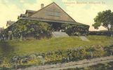
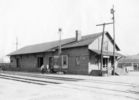
gladecoalstation.jpg431 viewsThis is an early 20th century view of the rail coaling station at Glade Spring.
100_1346.jpg
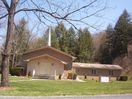
100_1346.jpg430 viewsFreedom Baptist Church is located on Poor Valley Road, just over the Washington county line from Saltville, Virginia. Photo by Jeff Weaver, March 26, 2006.
100_1438.jpg
100_1438.jpg430 viewsThis church is housed in the building that was formerly the school for African American children in Saltville. It is located on Smokey Row. Photo April 2, 2006 by Jeff Weaver
ehcollege1908.jpg
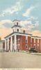
ehcollege1908.jpg430 viewsThis is a 1908 postcard view of the main Emory Building at the time.
pics 106.jpg
Abingdon - Martha Washington Inn429 viewsElegant, the Martha Washington Inn began life as Francis Preston's home. Click here to read more about it. Photo by Jeff Weaver, May 23, 2007.
100_1362.jpg
100_1362.jpg428 viewsPhoto by Jeff Weaver, March 29, 2006.
ehacademy1908.jpg
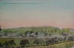
ehacademy1908.jpg428 viewsThis is a 1908 postcard.
pics 235.jpg
Tumbling Creek - Road to the Lake428 viewsThis road lies in the old railroad bed which led to the top of Clinch Mountain. There are numerous switchbacks. It leads to Laurel Bed Lake at the top of Clinch Mountain. Photo July 14, 2007 by Jeff Weaver.
269 files on 23 page(s) 11


[Edit]