Most viewed - Smyth County, VA
|

holstonvalley2.jpg570 viewsThis is a view of the Holston River Valley taken from the Skull's Gap overlook on Route 600 between Chiilhowie and Konnarock. Skull's Gap is in the Iron Mountain Range. The mountain in the distance is Walker mountain. Photo by Jeff Weaver, winter, 2003.
|
|

adundantlife.jpg570 viewsPhoto May 3, 2006 by Jeff Weaver.
|
|

pics 128.jpg569 viewsPhoto September 23, 2006 by Jeff Weaver.
|
|

marionmethodist.jpg568 viewsThis is from a 1940s postcard.
|
|

Picture 133.jpg567 viewsPhoto May 1, 2006 by Jeff Weaver.
|
|

pics 132.jpg567 viewsCartoon characters to entertain the kids at the 2006 Apple Festival. Photo by Jeff Weaver, September 26, 2006.
|
|
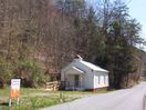
100_1413.jpg565 viewsPhoto April 2, 2006, by Jeff Weaver. This building was formerly a school.
|
|

Marion - Francis Brothers Hardware565 viewsPhoto March 2, 2007 by Jeff Weaver
|
|

Red Rock Mountain565 viewsRed Rock from White Top - Highlighted by snow, the Red Rock Mountain section of the Clinch Range stands out in the distance as a far away marker for what lies below...the town of Saltville. The shot was taken from atop White Top Mountain roughly 25 miles south of Red Rock as the crow flies. At the time, Saltville's downtown temperature was 45 degrees and the temperature on White Top was 27 degrees.
Photo by Don Smith.
|
|
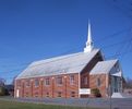
100_1284.jpg564 viewsPhoto by Jeff Weaver, March 18, 2006.
|
|
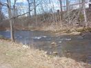
100_1310.jpg563 viewsView of the South Fork of Holston River at Thomas Bridge. Photo by Jeff Weaver, March 22, 2006.
|
|

piedmontschool.jpg563 viewsThis photo circa. 1910 or so, is courtesy of Sadie Stamper Greer. Note the steam engine to the extreme right of the image.
|
|
| 948 files on 79 page(s) |
 |
|
|
|
|
|
|
|
|
63 | |
|
|
|
|
|
|
|
|




