Skip to content

New River Notes Photo Gallery

A Collection of historic and current photos mostly covering the upper New River area of southwestern Virginia and northwestern North Carolina.


Most viewed - Smyth County, VA
000_0088.jpg
000_0088.jpg727 viewsPhoto by Jeff Weaver, March 1, 2006.
000_0697.JPG
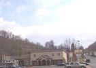
000_0697.JPG727 viewsThis photo from 2005 shows 304 East Main Street in the center of the scene.
pic 015.jpg
pic 015.jpg726 viewsPhoto by Jeff Weaver May 2006.
rosemont.jpg
rosemont.jpg725 viewsThe home of Sherwood Anderson in Marion.
chilhowiemills2.jpg
chilhowiemills2.jpg725 viewsThis photo is from the mid-20th century. Courtesy of Katherine Beattie.
churchridge.jpg
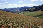
Saltville - Church Ridge725 viewsLOOKING NORTHEAST / CHURCH RIDGE IN RED CLOVER / SALTVILLE, VA. / AUGUST 1963. Courtesy of Don Smith dsmith1043@comcast.net

mccreadygaprhodys.jpg
McCready Gap - Rhododendron Thicket725 viewsRhododendron thicket at Maccrady Gap. Abingdon quadrangle. Virginia. No date, bu circa 1910. From the U.S. Geological Survey.
mathieson1920a.jpg
mathieson1920a.jpg724 viewsThis view is circa. 1920.
000_0702.JPG
000_0702.JPG724 viewsThis is the Mexican Restaurant located in downtown Saltville. Photo by Jeff Weaver, June 2005.
JAN18SALTVILLE1997504~0.jpg
Saltville - Aerial View724 viewsThis August 28, 1997 photo is by Don Smith dsmith1043@comcast.net
Marionryevalley.jpg
Marion - Marion & Rye Valley Railroad Switchback724 viewsThis is from a 1912 postcard. Click here for a Wikipedia Article about the Marion & Rye Valley Railroad
DUKEENERGYGASLINEWALKERMT011.jpg
DUKEENERGYGASLINEWALKERMT011.jpg722 viewsDUKE ENERGY GAS LINE FROM VALLEY ROAD (RT. 610) LOOKING SOUTHEAST TOWARD WALKER MOUNTAIN ACROSS THE CHARLIE CLARK FARM. Courtesy of Don Smith dsmith1043@comcast.net
948 files on 79 page(s) 37


[Edit]