Most viewed - Grayson County and City of Galax, VA
|
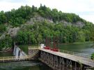
Fries - Dam on New River653 viewsPhoto May 17, 2007 by Don Smith dsmith1043@comcast.net
|
|

peachbottommill.jpg652 viewsThis circa 1900 image shows a grist mill on Peach Bottom Creek, just north of the town of Independence.
|
|
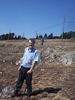
100_1999.jpg652 viewsPhoto by Patti Weaver, March 25, 2007
|
|

AnotherviewGWPark_shomeplace.jpg651 viewsCourtesy of Carol Lindamood circuitrider@tcia.net
|
|
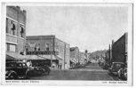
galax30s.jpg650 viewsThis view of main street in Galax is taken from a 1930s era postcard.
|
|
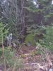
100_1913.jpg650 viewsPhoto by Jeff Weaver, December 6, 2006. These trees and rocks are just a few feet from the summit at 5560 feet.
|
|

Gold Hill - Flame Azaela or Honeysuckle.650 viewsThis shot was taken on what was originally William Hash's (generally referred to as William Horton Hash) farm near Bridle Creek. Photo May 11, 2007 by Jeff Weaver.
|
|
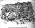
houkhse.jpg648 viewsCourtesy of Thom Houk.
|
|
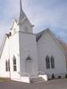
Grant - Grant United Methodist Church647 viewsPhoto March 31, 2006 by Jeff Weaver.
|
|
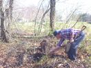
100_1476.jpg647 viewsThis presumed cemetery was located on Fisher's Gap Road South of Galax. It is reported that this is the site of the burial of some Tories killed in a skimish near this site in 1780. Only one was identified as a Hampton from near Baywood. Further information would be appreciated jweaver300@aol.com
|
|

Comers Rock - Victorian Home647 viewsPhoto by Jeff Weaver, March 21, 2008.
|
|
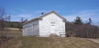
Barton's Cross Roads - Barton's Cross Roads Primitive Baaptist Church646 viewsThis building is on the Flat Ridge Road not far from Grant. Photo by Jeff Weaver, Spring 2003.
|
|
| 631 files on 53 page(s) |
 |
|
|
|
|
|
|
|
|
26 | |
|
|
|
|
|
|
|
|




