Skip to content

New River Notes Photo Gallery

A Collection of historic and current photos mostly covering the upper New River area of southwestern Virginia and northwestern North Carolina.


Most viewed - Tazewell County, VA
pics 075.jpg
pics 075.jpg317 viewsThis is Laurel Gap Mountain. Photo September 20, 2006 by Jeff Weaver.
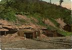
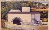
pocahontasmine.jpg
pocahontasmine.jpg314 viewsThis is a 1930-45 view of the entrance to the exhibition coal mine at Pocahontas, Virginia.
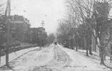
tazewellmain1926.jpg
tazewellmain1926.jpg313 viewsThis is a 1926 view of Tazewell's Main Street.
richlands~0.jpg
richlands~0.jpg312 viewsThis is a 1930-45 view of the scenery near Richlands, Va.
richlandspasture1937.jpg
richlandspasture1937.jpg312 viewsThis 1937 postcard shows some of the blue-grass pasture land available 70 years ago.
mapleshadecem.jpg
mapleshadecem.jpg310 viewsThis view of the Maple Shade Cemetery was taken about 1920.
pics 081.jpg
pics 081.jpg310 viewsWitten's Fort is located adjacent to the Crab Orchard Museum west of Tazewell, VA. Photo September 20, 2006 by Jeff Weaver.
tazewell4-2.jpg
Tazewell - Schools and Church307 viewsThis is from a 1930s era linen postcard.
brittsrestaurant.jpg
brittsrestaurant.jpg306 viewsPhoto from 1960s postcard.
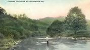
richlandsfishing.jpg
richlandsfishing.jpg305 viewsThis postcard was created circa. 1910
tannersville101963.jpg
tannersville101963.jpg305 viewsTHIS PICTURE WAS TAKEN FROM HWY 16 ON BRUSHY MOUNTAIN LOOKING NORTHEAST INTO THE ROARING FORK AREA OF THE JEFFERSON NATIONAL FOREST. THIS IS THE NORTHEAST END OF THE SAME VALLEY THAT HOLDS TANNERSVILLE. This image was made October 1963 by Dom Smith dsmith1043@comcast.net
tazemeth.jpg
Tazewell - Tazewell Methodist Episcopal Church303 viewsThis is from an early 1930s linen postcard.
56 files on 5 page(s) 4