Skip to content

New River Notes Photo Gallery

A Collection of historic and current photos mostly covering the upper New River area of southwestern Virginia and northwestern North Carolina.


Most viewed - Tazewell County, VA
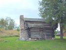
pics 082.jpg
pics 082.jpg362 viewsThis building is on the grounds of the Crab Orchard Museum and Pioneer Park. Photo September 20, 2006 by Jeff Weaver.
pics 073.jpg
pics 073.jpg356 viewsThis historical marker is located at the Smyth/Tazewell County line on VA Route 91 near Tannersville. Photo September 20, 2006 by Jeff Weaver.
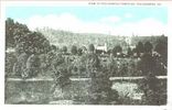
grahamva1910.jpg
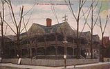
grahamva1910.jpg348 viewsThis view is from a circa 1910 postcard.
DUKEENERGYGASLINE035.jpg
DUKEENERGYGASLINE035.jpg346 viewsLOOKING SOUTHEAST ACROSS THE LITTLE VALLEY / TANNERSVILLE AREA. THE GAS LINE WILL CROSS THE EAST END OF FLAT TOP MOUNTAIN...THEN CROSS TANNERSVILLE AND BRUSHY MOUNTAIN...CROSS RICH VALLEY AND THEN WALKER MOUNTAIN AND HOOK UP WITH THE EAST TENNESSEE GAS LINE NEAR I-81 BETWEEN CHILHOWIE AND MARION. THE LINE IS UNUSUAL IN THAT IT IS RUNNING NORTH-SOUTH. MOST FOLLOW THE VALLEY FLOORS IN A SOUTHWEST-NORTHEAST DIRECTION.

Courtesy of Don Smith dsmith1043@comcast.net
pocahontascem1920.jpg
pocahontascem1920.jpg345 viewsThis is a circa 1920 postcard view.
greeverhousetaze.jpg
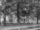
greeverhousetaze.jpg344 viewsThis is a circa 1935 photo of this house in Tazewell.
malletwreck.jpg
malletwreck.jpg344 viewsThis post card is circa 1910.
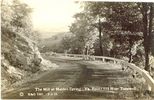
maidenspringmill.jpg
maidenspringmill.jpg342 viewsThis is a 1931 postcard.
tannersvilleoctor2007.jpg
Tannersville - Pastoral Scene340 viewsTannersville in October. Courtesy of Don Smith dsmith1043@comcast.net
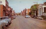
tazewellmain1957.jpg
tazewellmain1957.jpg338 viewsThis view of Tazewell's main street is from 1957.
pocahontascoal1907.jpg
pocahontascoal1907.jpg338 viewsThis circa 1905 photograph shows a block of coal 12 feet thick at Pocahontas, Virginia.
ntazewell1909.jpg
ntazewell1909.jpg336 viewsThis is a 1909 postcard view of North Tazewell.
56 files on 5 page(s) 2