Last additions - Tazewell County, VA
|

richlandsbarite.jpg356 viewsThis is a circa 1905 photo of the Pittsburg Baryta and Milling Corporation's facility at Richlands, Tazewell County, VA.Jun 08, 2006
|
|

DUKEENERGYGASLINE020.jpg427 viewsTHIS IS THOMPSON VALLEY IN TAZEWELL COUNTY. IT'S NORTH OF SALTVILLE OVER BEYOND FLAT TOP MOUNTAIN. THE GAS LINE IS 32 MILES LONG AND IS COMING FROM JEWEL RIDGE AND WILL HOOK UP WITH EAST TENNESSEE NATURAL GAS NEAR MARION. PROJECT SHOULD BE COMPLETED BY NOVEMBER 2006.
Courtesy of Don Smith dsmith1043@comcast.netJun 07, 2006
|
|
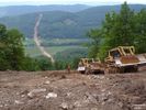
DUKEENERGYGASLINE035.jpg389 viewsLOOKING SOUTHEAST ACROSS THE LITTLE VALLEY / TANNERSVILLE AREA. THE GAS LINE WILL CROSS THE EAST END OF FLAT TOP MOUNTAIN...THEN CROSS TANNERSVILLE AND BRUSHY MOUNTAIN...CROSS RICH VALLEY AND THEN WALKER MOUNTAIN AND HOOK UP WITH THE EAST TENNESSEE GAS LINE NEAR I-81 BETWEEN CHILHOWIE AND MARION. THE LINE IS UNUSUAL IN THAT IT IS RUNNING NORTH-SOUTH. MOST FOLLOW THE VALLEY FLOORS IN A SOUTHWEST-NORTHEAST DIRECTION.
Courtesy of Don Smith dsmith1043@comcast.netJun 07, 2006
|
|
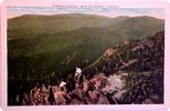
pinnaclerock.jpg362 viewsFrom a 1920s era postcard.May 18, 2006
|
|

grahamva1910.jpg384 viewsThis view is from a circa 1910 postcard.May 06, 2006
|
|

peaktazewell.jpg374 viewsThis is a 1909 postcard.Jan 31, 2006
|
|

mapleshadecem.jpg361 viewsThis view of the Maple Shade Cemetery was taken about 1920.Jan 27, 2006
|
|

wittenmill.jpg368 viewsThis view of the ruins of Witten's Mill was made in the early 20th century.Jan 27, 2006
|
|
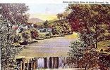
clinchriver.jpg487 viewsThis view of the Clinch River is from the 1930-45 era.Jan 27, 2006
|
|
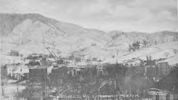
tazewell1906south.jpg363 viewsThis photographic view was created in 1906.Jan 27, 2006
|
|
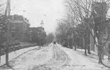
tazewellmain1907.jpg353 viewsThis view of Main Street was taken in 1907. Compare to the 1957 view.Jan 27, 2006
|
|
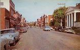
tazewellmain1957.jpg372 viewsThis view of Tazewell's main street is from 1957.Jan 27, 2006
|
|
| 56 files on 5 page(s) |
 |
 |
4 |
|


