Last additions - Tazewell County, VA
|

richlandspasture1937.jpg341 viewsThis 1937 postcard shows some of the blue-grass pasture land available 70 years ago.Oct 21, 2006
|
|

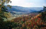
tannersville101963.jpg344 viewsTHIS PICTURE WAS TAKEN FROM HWY 16 ON BRUSHY MOUNTAIN LOOKING NORTHEAST INTO THE ROARING FORK AREA OF THE JEFFERSON NATIONAL FOREST. THIS IS THE NORTHEAST END OF THE SAME VALLEY THAT HOLDS TANNERSVILLE. This image was made October 1963 by Dom Smith dsmith1043@comcast.netOct 14, 2006
|
|

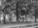
greeverhousetaze.jpg370 viewsThis is a circa 1935 photo of this house in Tazewell.Oct 06, 2006
|
|

pics 084.jpg355 viewsOrganized in 1793, this is the oldest congregation in Tazewell County, VA. This is their third building. It is located a few miles west of Tazewell on the north side of US 460. The church's web presence may be found here. Photo September 20, 2006 by Jeff Weaver.Sep 20, 2006
|
|

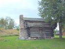
pics 082.jpg392 viewsThis building is on the grounds of the Crab Orchard Museum and Pioneer Park. Photo September 20, 2006 by Jeff Weaver.Sep 20, 2006
|
|

pics 081.jpg335 viewsWitten's Fort is located adjacent to the Crab Orchard Museum west of Tazewell, VA. Photo September 20, 2006 by Jeff Weaver.Sep 20, 2006
|
|

pics 079.jpg310 viewsPhoto September 20, 2006 by Jeff Weaver.Sep 20, 2006
|
|

pics 077.jpg410 viewsPhoto September 20, 2006 by Jeff WeaverSep 20, 2006
|
|

pics 075.jpg343 viewsThis is Laurel Gap Mountain. Photo September 20, 2006 by Jeff Weaver.Sep 20, 2006
|
|

pics 074.jpg330 viewsPhoto September 20, 2006 by Jeff Weaver.Sep 20, 2006
|
|

pics 073.jpg391 viewsThis historical marker is located at the Smyth/Tazewell County line on VA Route 91 near Tannersville. Photo September 20, 2006 by Jeff Weaver.Sep 20, 2006
|
|

richlands1938.jpg403 viewsThis is a 1938 general view of the village of Richlands, VA.Aug 31, 2006
|
|
| 56 files on 5 page(s) |
2 |  |
 |
|


