|
|

100_1631.jpg358 viewsThis is the view of the Middle Fork of the Holston River from Old Ebenezer Road, south of Marion. Photo April 23, 2006 by Jeff Weaver.
|
|

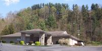
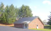
100_1632.jpg337 viewsThe roadside sign, on Highway 11, south of Marion says this is the Impact Church. The sign over the door notes taht it is Impace International Ministries. Photo April 23, 2006 by Jeff Weaver.
|
|

Marion- Mount Pleasant Methodist Church350 viewsThis was the meeting house for African-American Methodists in Marion for many years. This facility is now closed. Photo April 23, 2006 by Jeff Weaver.
|
|

100_1635.jpg322 viewsPhoto April 23, 2006 by Jeff Weaver.
|
|

100_1637.jpg317 viewsPhoto April 23, 2006 by Jeff Weaver.
|
|

100_1638.jpg387 viewsPhoto April 23, 2006 by Jeff Weaver.
|
|

100_1639.jpg347 viewsLocated on Highway 16 between Sugar Grove and Marion, this church photo was made April 23, 2006 by Jeff Weaver.
|
|

100_1640.jpg366 viewsLocated on Highway 16 between Marion and Sugar Grove, this photo is the Blessed Hope Baptist Church. Photo April 23, 2006 by Jeff Weaver.
|
|

100_1641.jpg320 viewsPhoto April 23, 2006 by Jeff Weaver
|
|

100_1642.jpg334 viewsPhoto April 23, 2006 by Jeff Weaver.
|
|

100_1643.jpg360 viewsPhoto April 23, 2006 by Jeff Weaver.
|
|

100_1644.jpg456 viewsThis Lime Kiln was photographed on April 23, 2006 by Jeff Weaver. In order to produce lime for agricultural use, limestone was dumped into the top of the furnance and heated. A troll car ran in the enterance at the bottom and pulled out when sufficiently broken down limestone was produced. It was then transferred to wagons and hauled to where needed. This faciility was last used in the 1920s. Information courtesy of Jesse Choate.
|
|
| 948 files on 79 page(s) |
 |
 |
 |
 |
 |
 |
 |
 |
 |
16 |  |
 |
 |
 |
 |
 |
 |
 |
|

