Skip to content

New River Notes Photo Gallery

A Collection of historic and current photos mostly covering the upper New River area of southwestern Virginia and northwestern North Carolina.

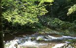
Tumbling Creek - Clinch Mountain
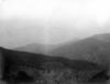
Clinch Mountains from gap south of Beartown Mountain. Distant sharp peak is Whiterock; high ridge at right is Redrock with dip slope of Clinch sandstone on left forming syncline with distant ridge. Abingdon quadrangle. Virginia. No date. From the US Geological Service

Tumbling Creek - Clinch Mountain

Clinch Mountains from gap south of Beartown Mountain. Distant sharp peak is Whiterock; high ridge at right is Redrock with dip slope of Clinch sandstone on left forming syncline with distant ridge. Abingdon quadrangle. Virginia. No date. From the US Geological Service

whitesmillabingdon.jpg whitetoplaurelcreekfalls.jpg tumblingcreekfalls3.jpg abingdonbranchsteam.jpg clinchmtns1.jpg washhotelglade.jpg pics 451.jpg creekjunction.jpg 100_2012.jpg

[Edit]