|
|

plastermine1905.jpg456 viewsThis circa 1905 view shows an opening from which gypsum was mined near Saltville.
|
|
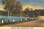
mtncitypostcard1942.jpg456 viewsThis 1942 postcard announces greetings from Mountain City. Problem is, this doesn't look anything like Mountain City.
|
|

100_1381.jpg455 viewsPhoto by Jeff Weaver, March 31, 2006.
|
|
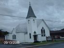
pics 038.jpg455 viewsPhoto September 13, 2006 by Jeff Weaver.
|
|

Blowing Rock - View of Village455 viewsThis view of the village of Blowing Rock was taken from the Moses Cone Estate in 1930.
|
|

Mitchell, Gabriel Family455 viewsLeft to right, Pearl, Grandpa Mitchell, Minnie, Annie, Nicollie, Husie, HBoss, John & Squire. The Baby is Nicollie's and the little girl is Pearl's. Courtesy of David Arnolddavid-arnold@comcast.net
|
|
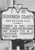
This is an example of the historical markers that used to dot the VA landscape. 455 views
|
|

rt11abingdon.jpg454 viewsThis is a 1930-45 view of Route 11 between Abingdon and Bristol.
|
|
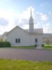
100_1657.jpg454 viewsPhoto April 23, 2006 by Jeff Weaver.
|
|
july2006pic 026.jpg454 viewsThis is photo was taken July 22, 2006 by Jeff Weaver. It shows the Black Rock located on U.S.21 north of Independence.
|
|
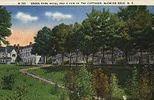
greenpark.jpg453 viewsThis image from the early 20th century is taken from an old postcard.
|
|

abingdonmeth1920.jpg453 viewsThis postcard image was created in the 1920s.
|
|
| 4754 files on 397 page(s) |
 |
|
|
|
|
|
|
|
|
365 | |
|
|
|
|
|
|
|
|