|
|
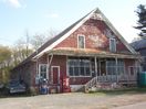
100_1656.jpg567 viewsThis old country store sits about 100 yards in Smyth County from the Wythe County line on Cedar Springs Road. Photo April 23, 2006 by Jeff Weaver.
|
|

piedmontschool.jpg567 viewsThis photo circa. 1910 or so, is courtesy of Sadie Stamper Greer. Note the steam engine to the extreme right of the image.
|
|
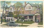
carlheimhotel1920s.jpg567 viewsThis is a 1920s postcard view.
|
|
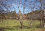
100_1760.jpg567 viewsThis photo was taken October 18, 2006 by Jeff Weaver. This field located near the intersection of U.S. 58 and VA 16 shows the antebellum Grayson County militia muster ground. The militia met here to perform military drills.
|
|
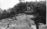
Backbone Rock - Top of Backbone Rock567 viewsThis ca. 1940 postcard shows a group on the top of Backbone Rock.
|
|
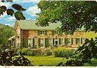
Troutdale - Ripshin567 viewsThis home was built for author Sherwood Anderson. From a 1950s postcard.
|
|
Buffalo Creek, Near Lenoir567 views
|
|
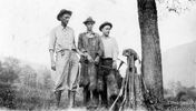
FARRISHOGSTONHENDERSON408.jpg566 viewsHUNTING TRIP TO BIG TUMBLING COVE...PICTURED FROM LEFT IS SID FARRIS, ROB HOGSTON, AND BOLEN HENDERSON. THE DATE IS OCTOBER 2, 1926.
Photo courtesy of Don Smith dsmith1043@comcast.net
|
|
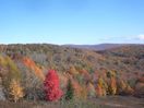
Haw Orchard - Sugarlands566 viewsThis photo was taken on October 18, 2006 by Jeff Weaver in Grayson Highlands State Park. It shows the color changes in the Sugar Maples this year.
|
|

Jefferson - Mount Jefferson Baptist Church566 viewsPhoto by Jeff Weaver, May 16, 2007.
|
|

Fox - Fox Creek Primitive Baptist Church Cemetery566 viewsPhoto by Jeff Weaver, May 30, 2007.
|
|

Fees Ridge - Gold Mine Tailings Pile566 viewsPhoto September 2007 by Jeff Weaver. This is the remnant of a gold mine that was exhausted in the late 19th century.
|
|
| 4754 files on 397 page(s) |
 |
|
|
|
|
|
|
|
|
295 | |
|
|
|
|
|
|
|
|




