|
|

Mouth of Wilson - Potato Creek Methodist Church Cemetery757 viewsCourtesy of Misty Martin
|
|

Saltville - General Town View757 viewsPhoto taken from Angle Junction hill behind overlook / 300mm telephoto lens. Photos taken by Don Smith October 24, 2010.
|
|

whitetopff.jpg756 viewsThis historical marker is located on Route 600 near the summit of Whitetop Mountain. Photo was taken in March 2003 by Jeff Weaver
|
|

Hoffman's Store - Grant756 viewsLocal landmark. Photo by Jeff Weaver, March 31, 2006.
|
|
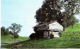
wittensfort.jpg756 viewsThis is a relatively modern photo of Witten Fort, built during Lord Dunmore's War (1774).
|
|

bigspringelliston.jpg756 viewsThis is from a 1910-20 postcard.
|
|

Saltville - Madam Russell Methodist Church Sanctuary756 viewsThis December 24, 2006 photo by Jerry W. Catron shows the interior sanctuary of Madam Russell United Methodist Church.
|
|

Christiansburg - Montgomery College756 viewsThis image is from a 1911 postcard.
|
|

Weaver's Ford - Nathan Phipps gravestone756 viewsThis grave is in New River Baptist Church Cemetery. Photo July 18, 2007 by Jeff Weaver.
|
|

Elizabethton - Main Street756 viewsAnother view of Main Street from a late 1950s postcard.
|
|

Saltville - Mathieson Alkali Works Stock Certoficate756 viewsFromth 1930s
|
|

100_1475.jpg755 viewsThis photo shows Grayson county Historical Society President Lou Kurtz digging searching for grave markers in what is reported to be the site of the grave of a Tory hung in 1780.
|
|
| 4754 files on 397 page(s) |
 |
|
|
|
|
|
|
|
|
223 | |
|
|
|
|
|
|
|
|