|
|
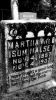
Mouth of Wilson - Potato Creek Methodist Church Cemetery815 viewsImage of Martha Halsey's gravemarker, Courtesy of Misty Martin.
|
|
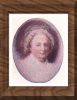
Martha Washington815 viewsPortrait of Martha Washington by Gilbert Stuart
|
|
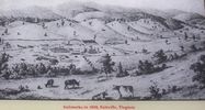
saltville1860.jpg814 viewsCourtesy of the Museum of the Middle Appalachians.
|
|

lheltonbc.jpg814 viewsPhoto by Jeff Weaver, Summer 2003.
|
|
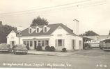
wythevillebusdepot.jpg814 viewsFrom a 1950s real photo postcard
|
|

idlewildschool.jpg814 viewsCourtesy of Bette Nelson
|
|

DUKEENERGYGASLINEWALKERMT011.jpg814 viewsDUKE ENERGY GAS LINE FROM VALLEY ROAD (RT. 610) LOOKING SOUTHEAST TOWARD WALKER MOUNTAIN ACROSS THE CHARLIE CLARK FARM. Courtesy of Don Smith dsmith1043@comcast.net
|
|

wilkescampyard.jpg814 viewsThis circa 1910 postcard shows the camp ground for wagons travelling through Wilkesboro.
|
|
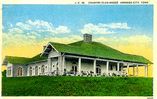
countryclub.jpg814 viewsThis is from a 1929 postcard.
|
|

newriverrr.jpg814 viewsThis 1940s postcard shows the line of the Norfolk and Western Railroad near Warrensville, NC.
|
|

Allison Gap - Geological Formations814 viewsRidge making ledge of Price Mountain, probably to of Chemung strata, Allison Gap. Abingdon quadrangle. Virginia. No date,but circa 1910.
Image from the U.S. Geological Survey
|
|

obidsbc.jpg813 viewsThis photo was made in the early 1970s.
|
|
| 4754 files on 397 page(s) |
 |
|
|
|
|
|
|
|
|
197 | |
|
|
|
|
|
|
|
|