|
|

CEDARBRANCH1956761.jpg795 viewsTHIS IS THE CEDAR BRANCH AREA LOOKING EAST FROM HWY 91 NEAR WHERE THE BRIDGE CROSSES THE RIVER ON EAST MAIN ST. THE PICTURE WAS MADE IN 1956 AND IS FROM THE WICK LAMIE COLLECTION.
Courtesy of DON SMITH dsmih1043@comcast.net
|
|

Allison Gap - Geological Formations795 viewsRidge making ledge of Price Mountain, probably to of Chemung strata, Allison Gap. Abingdon quadrangle. Virginia. No date,but circa 1910.
Image from the U.S. Geological Survey
|
|

Kelley, George795 viewsThis photo of George Kelley shows the Old Saltville o Town Museum in the background. This photo was taken August 33, 2010 by Don Smith.
|
|

boone1930.jpg794 viewsThis view of Boone is taken from a 1930s era postcard.
|
|

newriverbridge.jpg794 viewsI think this is a 1930s shot of what is locally called Sheets Bridge, between Jefferson and Glendale Springs.
|
|

923.jpg794 viewsThis is a photo of the Wolf Knob School taken in January 1913.
|
|

houk9.jpg794 viewsCourtesy of Thom Houk.
|
|
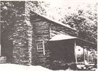
sturgillfranciscabin.jpg794 viewsThis photo made in the late 1970s shows the cabin of Francis Sturgill, Jr. and Phebe Weaver Sturgill. It is located on Helton Creek, about a quarter mile from the Virginia line in Ashe County, NC. Francis Sturgill (1782-1842) was the son of Francis Sturgill, Sr. and Rebecca Hash. Phebe Weaver 1783-1855 was the daughter of William Weaver, Sr. and his first wife, who was a daughter of Moses McDaniel.
|
|
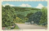
firetower.jpg794 viewsThis is a 1930-45 era postcard.
|
|
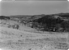
wythevillefarmsecene.jpg793 viewsThis is a November 1940 photo showing a farm scene near Wytheville. From the Farm Security Administration files at the Library of Congress.
|
|
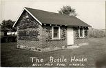
bottlehouse.jpg793 viewsFrom a 1955 postcard.
|
|
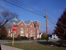
100_1817.jpg793 viewsThis photo was taken November 1, 2006 by Jeff Weaver.
|
|
| 4754 files on 397 page(s) |
 |
|
|
|
|
|
|
|
|
189 | |
|
|
|
|
|
|
|
|




