|
|

Davis, John Franklin1032 viewsThis 1907 photo shows John Franklin Davis, at age 35, shortly before he moved to Walla Walla, WA. John Franklin Born 02 Oct 1872, and Cora E. C. Davis Kelly are the chidren of Elisha Davis Born 18 Jan 1844, and Johannah (Spencer) Davis Born 1836. they have a youger sister named Rosa L. Davis, all born in Grayson Co., Virginia. Most likly Wilson Creek. Courtesy of Vale Duane Davis vdavis@ix.netcom.com
|
|

Davis, Elisha Carl1032 viewsThis 1907 photo shows Elisha Carl Davis, at age 6. He was the son of John Franklin Davis and Cora Ann Seagraves, shortly before he moved to Walla Walla, WA. Courtesy of Vale Duane Davis vdavis@ix.netcom.com
|
|

Foster Falls - Galenea Methodist Church1032 viewsThe white church is the Galena Methodist Church on US 52 at it's intersection with Major Graham's Road. Hannah Walton Sanders (1806-1876) mentions this church in her Civil-War diary http://home.alltel.net/cjwalker/ Photo by Shawn Dunford. Courtesy of David Arnold david.arnold@adelphia.net
|
|

Saltville - Railroad Bridge Over the North Fork of Holston River1032 viewsPhoto May 2007 by Jerry W. Catron.
|
|

Cook, Bill; McCoy, Bob and Rhea, Max1032 viewsFROM LEFT - BILL COOK, R. B. WORTHY BAND DIRECTOR / BOB McCOY, R. B. WORTHY PRINCIPAL / MAX RHEA, SALTVILLE ELEMENTARY PRINCIPAL / 1966
SALTVILLE PROGRESS PHOTO. Courtesy of Don Smith dsmith1043@comcast.net
|
|

CB_sbaseballteam.jpg1031 viewsCourtesy of Emily Kilby.
|
|

weaverray~0.jpg1031 views
|
|

pics 141.jpg1031 viewsThe Patrick Henry High School Marching Band. Photo September 23, 2006 by Jeff Weaver.
|
|
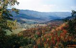
tannersville101963.jpg1031 viewsTHIS PICTURE WAS TAKEN FROM HWY 16 ON BRUSHY MOUNTAIN LOOKING NORTHEAST INTO THE ROARING FORK AREA OF THE JEFFERSON NATIONAL FOREST. THIS IS THE NORTHEAST END OF THE SAME VALLEY THAT HOLDS TANNERSVILLE. This image was made October 1963 by Dom Smith dsmith1043@comcast.net
|
|

pic 055.jpg1031 viewsAn example of an above ground grave in Aspenvale cemetery. Photo by Jeff Weaver.
|
|
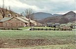
craborchard.jpg1031 viewsThis postcard is from the 1970s.
|
|

pics 010.jpg1030 viewsThis photo was taken September 10, 2006 by Jeff Weaver at the Jumping Off Place just over the Wilkes County line from Glendale Springs. This view shows the Blue Ridge in the distance.
|
|
| 4754 files on 397 page(s) |
 |
|
|
|
|
|
|
|
|
102 | |
|
|
|
|
|
|
|
|