Skip to content

New River Notes Photo Gallery

A Collection of historic and current photos mostly covering the upper New River area of southwestern Virginia and northwestern North Carolina.


Most viewed - Virginia Counties
000_0638.jpg
000_0638.jpg801 viewsLocated near Chilhowie, Smyth County, this photo was taken by Jeff Weaver in summer 2005.
galaxox1907.jpg
galaxox1907.jpg801 viewsFrom a real photo postcard, dated 1907
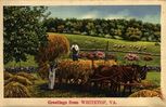
whitetopcard1940s.jpg
whitetopcard1940s.jpg801 viewsIn the mid-20th century a number of fantasy postcards were issued. This is one of them.
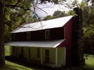
GWParkshomeRobertsCove.jpg
GWParkshomeRobertsCove.jpg800 viewsCourtesy of Carol Lindamood circuitrider@tcia.net
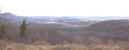
holstonvalley2.jpg
holstonvalley2.jpg800 viewsThis is a view of the Holston River Valley taken from the Skull's Gap overlook on Route 600 between Chiilhowie and Konnarock. Skull's Gap is in the Iron Mountain Range. The mountain in the distance is Walker mountain. Photo by Jeff Weaver, winter, 2003.
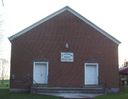
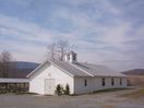
100_1384.jpg
Troutdale - Comer's Creek Baptist Church799 viewsPhoto by Jeff Weaver March 31, 2006.
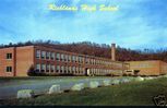
richlandshs.jpg
richlandshs.jpg799 viewsFrom a 1960 era postcard.
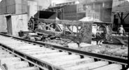
mawrailtracks.jpg
mawrailtracks.jpg799 viewsThis scene from the late 1930s, shows railroad tracks and miscellaneous equipment at the Mathieson Alkali Works in Saltville. Photo by John Porter.
middlefox.jpg
Roberts Cove - Middle Fox Creek799 viewsPhoto March 21, 200 by Jeff Weaver
ShannonsRock.jpg
ShannonsRock.jpg798 viewsTHIS IS ANOTHER PICTURE (circa 1912) FROM THE BATCH GIVEN TO ME BY LULA SHANNON (on the right) IN THE LATE 60's. IT WAS IN WITH THE PICS OF THE HOUSE WHERE YOU ARE NOW LIVING. NO NAMES WERE WITH THE PICTURES. COULD EITHER OF THE MEN BE DR. EARLY? Courtesy of Don Smith dsmith1043@comcast.net

sodaashbulkloader1942.jpg
sodaashbulkloader1942.jpg798 viewsThis is a 1941-42 photo showing some of the industrial processes at Mathieson Alkali Works.
DUKEENERGYGASLINE020.jpg
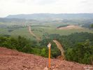
DUKEENERGYGASLINE020.jpg797 viewsTHIS IS THOMPSON VALLEY IN TAZEWELL COUNTY. IT'S NORTH OF SALTVILLE OVER BEYOND FLAT TOP MOUNTAIN. THE GAS LINE IS 32 MILES LONG AND IS COMING FROM JEWEL RIDGE AND WILL HOOK UP WITH EAST TENNESSEE NATURAL GAS NEAR MARION. PROJECT SHOULD BE COMPLETED BY NOVEMBER 2006.

Courtesy of Don Smith dsmith1043@comcast.net
2351 files on 196 page(s) 93