Skip to content

New River Notes Photo Gallery

A Collection of historic and current photos mostly covering the upper New River area of southwestern Virginia and northwestern North Carolina.


Most viewed - Virginia Counties
pics 025.jpg
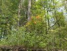
Gold Hill - Flame Azaela or Honeysuckle.660 viewsThis shot was taken on what was originally William Hash's (generally referred to as William Horton Hash) farm near Bridle Creek. Photo May 11, 2007 by Jeff Weaver.
100_1283.jpg
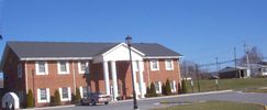
Chilhowie Town Hall659 viewsTown Hall in Chilhowie is located on the west side of U.S. 11 (Lee Highway) in the town of Chilhowie. Photo by Jeff Weaver, March 18, 2006.
100_1389.jpg
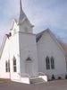
Grant - Grant United Methodist Church659 viewsPhoto March 31, 2006 by Jeff Weaver.
100_1999.jpg
100_1999.jpg659 viewsPhoto by Patti Weaver, March 25, 2007
stoneschapelrd~0.jpg
Elk Creek - Stone's Chapel road659 viewsStone's Chapel Road, Elk Creek District. Photo by Shawn Dunford. Courtesy of David Arnold[emai;]david-arnold@comcast.net{.email]
bridleck.jpg
bridleck.jpg658 viewsPhoto taken in the 1930s.
sideviewFlatRockUMC.jpg
sideviewFlatRockUMC.jpg658 viewsCourtesy of Carol Lindamood circuitrider@tcia.net
100_1547.jpg
100_1547.jpg658 viewsPhoto April 14, 2006 by Jeff Weaver.
pics 114.jpg
pics 114.jpg658 viewsSome of the agricultural exhibits at the 2006 Chilhowie Apple Festival.
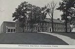
christiansburghs.jpg
christiansburghs.jpg657 viewsThis is a postcard view of the High School in Christiansburg from the 1920s.
100_1477.jpg
Galax - Galax School656 viewsPhoto April 7, 2006 by Jeff Weaver
100_1476.jpg
100_1476.jpg656 viewsThis presumed cemetery was located on Fisher's Gap Road South of Galax. It is reported that this is the site of the burial of some Tories killed in a skimish near this site in 1780. Only one was identified as a Hampton from near Baywood. Further information would be appreciated jweaver300@aol.com
2351 files on 196 page(s) 126