Skip to content

New River Notes Photo Gallery

A Collection of historic and current photos mostly covering the upper New River area of southwestern Virginia and northwestern North Carolina.


Most viewed - Virginia Counties
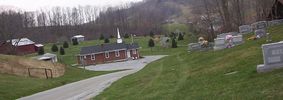
corinthbc.jpg
corinthbc.jpg712 viewsPhoto by Jeff Weaver 2003.
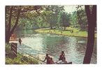
narrowspark1950s.jpg
narrowspark1950s.jpg712 viewsThis is from a 1950s postcard.
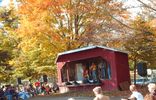
pics 225.jpg
pics 225.jpg711 viewsMaking music at the October 8, 2006 Whitetop Molasses festival. Photo by Jeff Weaver.
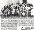
andersonharveyellis.jpg
andersonharveyellis.jpg711 viewsMy father, Harvey Ellis Anderson, is second from the left in the front row. It has always been my impression that he was the teacher at this school in Majors. I am not sure of his age at the time, but wonder how he qualified as a teacher. I have no idea where he might have attended school although I believe he briefly attended college at Valpairoso College or University somewhere in the midwest as he was returning to Grayson County from Washington State. (The only information I have about his time in Washington was that he and several friends climbed Mount Baker which he reported to a newspaper in Grayson. I have a copy of his "letter to the editor." Several of his siblings are also present in the picture and their names are underlined. Claude Testerman is also shown who married Harvey's sister, Laura. Courtesy of R. David Anderson rdandy1@cfw.com
stclairscreekubc.jpg
stclairscreekubc.jpg710 viewsPhoto by Jeff Weaver 2003
marionmain09.jpg
marionmain09.jpg710 viewsThis view of Marion was taken from a 1909 postcard.
tazewellmain1907.jpg
tazewellmain1907.jpg710 viewsThis view of Main Street was taken in 1907. Compare to the 1957 view.
fries1909a.jpg
fries1909a.jpg710 viewsThis is from a postcard mailed in 1909.
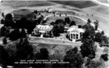
stalbans.jpg
stalbans.jpg710 viewsThis is from a 1930s real photo postcard.
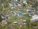
LOVER_SLEAPANDNEAROVERLOOKAPRIL152006043.jpg
LOVER_SLEAPANDNEAROVERLOOKAPRIL152006043.jpg709 viewsThis photo by Don Smith was taken April 15, 2006 from Lover's Leap and shows a view of the area of Saltville where East Main Street and Highway 107 come together.
saltville1905.jpg
saltville1905.jpg709 viewsThis is a circa 1905 view of the Saltville Well Fields.
100_1914.jpg
100_1914.jpg709 viewsPhoto by Jeff Weaver December 6, 2006.
2351 files on 196 page(s) 114