Most viewed - Smyth County, VA
|
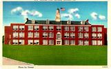
marionhs~0.jpg882 viewsThis is from a circa 1940 postcard.
|
|
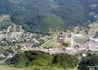
Saltville - Aerial View882 viewsThis August 28, 1997 photo is by Don Smith dsmith1043@comcast.net
|
|
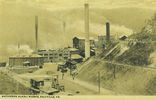
mathieson1920.jpg881 viewsThis is another view of the Mathieson operations ca. 1920.
|
|
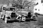
dunhamsyard.jpg881 viewsTHESE WERE MYRL DUNHAM'S CARS. THE BIG TREE IN THE BACK YARD WAS AN ENGLISH WALNUT. IT WAS PLANTED BY THE FAMILY THAT CAME TO SALTVILLE FROM ENGLAND WHEN THE MATHIESONS STARTED THE PLANT. THEY LIVED THERE FOR A FEW YEARS AND THEN RETURNED TO ENGLAND. THEIR NAME WAS BARNES.
IN 1902, M. S. DUNHAM CAME TO SALTVILLE FROM TITUSVILLE, PA. TO TAKE OVER THE WELL DRILLING OPERATIONS. HE LIVED IN THIS HOUSE AND ALSO SERVED AS MAYOR FOR A WHILE. HIS SON, HARRY, ALSO LIVED HERE. THE HOUSE IS NOW OWNED BY HARRY AND REBA DUNHAM'S DAUGHTER, MARY.
THE WALNUT TREE DIED SEVERAL YEARS AGO. THE PICTURE IS FROM APRIL OF 1957. Courtesy of Don Smith dsmith1043@comcast.net
|
|
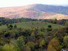
Saltville - Cows Grazing881 viewsCOWS GRAZING IN MEADOW BETWEEN WEST MAIN AND THE HOLSTON RIVER WITH LITTLE MOUNTAIN AND CLINCH MOUNTAIN IN BACKGROUND. LIGHT POLE IS STANDING IN THE OLD N&W / OLIN RAILWAY YARD JUST WEST OF THE MEDICAL CENTER.Courtesy oif Don Smith -dsmith1043@comcast.net
|
|
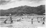
hmbeach1940s.jpg880 viewsThis 1940s photo postcard of Hungry Mother Park shows the Children's play beach.
|
|
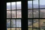
CHURCHANDSCHOOL290.jpg879 viewsThis view from inside the Preston House was taken in February 1976. Photo courtesy of Don Smith dsmith1043@comcast.net
|
|
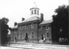
smytholdch.jpg879 viewsThis Court House was used from 1834 until the current one was built in 1904.
|
|
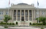
Marion - Smyth County Court House879 viewsPhoto June 30, 2007 by Jeff Weaver.
|
|
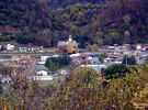
Saltville - From the Overlook879 viewsThis image was made on October 25, 2007 by Don Smith dsmith1043@comcast.net
|
|

McCready - McCready Gap Foilage879 viewsFoliage at Maccrady Gap. Abingdon quadrangle. Virginia. No date, but circa 1910, From the U.S. Geological Survey.
|
|
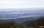
WHITEROCKSOLIN244.jpg878 viewsTHIS PICTURE WAS TAKEN IN JUNE OF 1972 FROM THE WEST END OF FLATTOP MOUNTAIN ON AN OUTCROPPING KNOWN AS THE WHITE ROCKS.
Courtesy of Don Smith dsmith1043@comcast.net
|
|
| 948 files on 79 page(s) |
 |
|
|
|
|
|
|
|
|
39 | |
|
|
|
|
|
|
|
|



